


Dive Site - USS Carlisle (APA-69)
| Dive Site - USS Carlisle (APA-69) | |||
| Dive Location: | City / Island: | ||
| USS Carlisle (APA-69) | Bikini Atoll | ||
| Country: | Rating: | Max. Depth: | Difficulty: |
| Marshall Islands |  |
52 m | Advanced Open Water plus Deep |
| Aquatic Name: | Water: | Altitude: | |
| - | Salt | 0 m | |
| GPS Latitude: | GPS Longitude: | GPS Datum: | |
| 11° 36.738′ N 11.6123° N 11° 36′ 44.28″ N |
165° 28.832′ E 165.480533° E 165° 28′ 49.92″ E |
Google Map | WGS84 |
| 2 dives at this location: | |||
| 369 | 419 | |||
| Map: | |||
 |
|||
| Comments: | |||
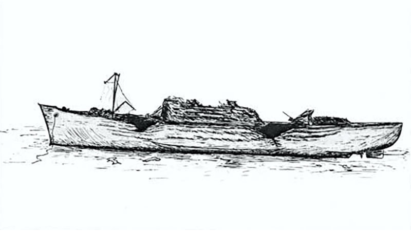
| The USS Carlisle (APA-69) was a Gilliam-class attack transport that served with the US Navy during World War II. Arriving late in the war, she was initially assigned to transport missions and consequently did not participate in any combat operations. She was less than two years old when assigned to the target fleet for Operation Crossroads at Bikini Atoll. For the "Test Able" air atomic bomb blast on 1 July 1946, the Carlisle was loaded nearly to capacity with fuel and ammunition, including rocket heads and incendiary clusters. Thrown 137 metres (150 yards) by the force of the blast, the ship was smoking heavily within three minutes and sank within forty minutes. While more intact than the USS Gilliam, the Carlisle shows plenty of atomic bomb damage, with her port side shell plating buckled, dented and dished. She now sits upright on the bottom. All along the port side of the ship, the hull has been folded like paper. Folds go horizontally along the entire length of the hull. Extensive damage to the superstructure and the main deck forward has caused it to collapse. The starboard side of the hull is largely intact. There are interesting artefacts on the main deck aft towards the stern. GPS: 11° 36.738' N, 165° 28.832' E See also: https://en.wikipedia.org/wiki/USS_Carlisle_(APA-69) |
|||