


Kwajalein Atoll - Island
| Kwajalein Atoll - Island | |||
| Name: | Type: | ||
| Kwajalein Atoll | Island | ||
| Map: | |||
 |
|||
| Comments: | |||
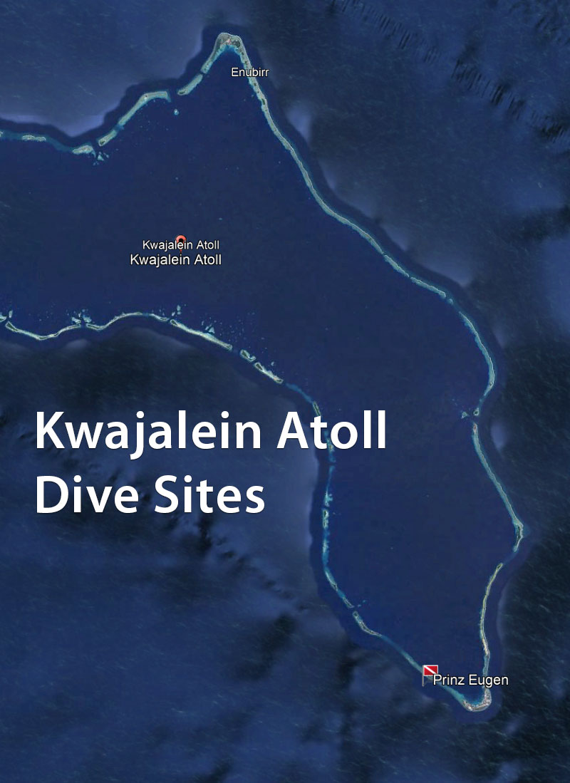
| Kwajalein Atoll is part of the Republic of the Marshall Islands. The southernmost and most significant island in the atoll is named Kwajalein Island, which English-speaking residents often call by the shortened name, Kwaj. The U.S. Navy has hosted a naval base on Kwajalein Island since World War II. It's the final resting place of the German cruiser Prinz Eugen after it survived the Operation Crossroads atomic bomb tests in July 1946. In the late 1950s, the U.S. Army took over the base as part of its Nike Zeus anti-ballistic missile efforts, and since then, the atoll has been widely used for missile tests of all sorts. Today, it is part of the Ronald Reagan Ballistic Missile Defence Test Site, or Reagan Test Site, with various radars, tracking cameras, missile launchers, and many support systems spread across many islands. One of the five ground stations used in controlling the operation of the Global Positioning System (GPS) navigation system is located on Kwajalein. When you fly into Kwajalein Island, you land at the Kwajalein Atoll Airport, also known as Bucholz Army Airfield. Since the entirety of Kwajalein Island is a military base, non-military passengers on commercial flights are transported to and from the neighbouring island of Ebeye, the civilian population centre of Kwajalein Atoll. Thankfully, the Military Police escorts are friendly. The Marshallese, many of whom work on the Kwajalein Island military base, live on Ebeye Island about 7.2 km north of eastern end of Kwajalein Island. With a size of just 32 hectares (80 acres) of land and a population of over 8,500 people, Ebeye is one of the most densely populated places in the world. Many of its residents live in poverty. The atoll lies in the Ralik Chain, at 8° 43'N 167° 44'E. See also: https://en.wikipedia.org/wiki/Kwajalein_Atoll https://en.wikipedia.org/wiki/Ronald_Reagan_Ballistic_Missile_Defense_Test_Site https://en.wikipedia.org/wiki/Bucholz_Army_Airfield https://en.wikipedia.org/wiki/Ebeye_Island |
|||
| Diving Activity at Kwajalein Atoll | |||
| 1 dive site at this City / Island: | |||
| Prinz Eugen | |||
| 3 dives at this City / Island: | |||
| 360 | 361 | 409 | |||