Profiting from Postcode
by Lloyd Borrett
Corporate Review, 1993
The postcode has profitable uses for every organisation.
This simple piece of information is the key to integrating
diverse sets of data about your existing and potential
customers.
Postcodes have obvious advantages over other possible
keys because they are widely used and understood.
Consider an insurance company as an example of how
postcode can be used to increase profits.
The company will have on file the postcode of every,
customer. Thus it is easy to determine the sales
distribution by postcode of the range of insurance products
sold. From there it is easy to spot which products do best
in which areas and hence plan a targeted marketing campaign
for those products in similar areas.
Result: targeted marketing, more customers, and increased
profits.
Alternatively, the insurance company can use the postcode
information on customers to design balanced sales
territories.
Result: sales efficiencies, and increased profits.
By analysing the postcode information on customers
together with competitor locations and key landmarks the
insurance company can identify attractive new office
locations.
Result: enhanced customer service, improved
competitiveness, and increased profits.
The insurance company could also analyse policy claims by
postcode. Customers living in areas prone to flooding, fire
or crime can easily be identified and policy rates adjusted
accordingly.
Result: decreased risk, increased profits.
The concept of using postcodes as the key to unlock
increased profits is applicable to most organisations, vet
few have done so. Why?
The simple answer is that most organisations don't think
spatially. They don't really consider where their customers
are located and the impact that has on how their operations
need to be structured to provide best for those customers.
Even fewer organisations consider how the location of
existing customers has implications as to where their
potential customers can be found.
A greater problem is that until recently even the
organisations that tried to think spatially found many
objects in their path. But that is changing rapidly.
Today new tools are becoming available that make it
possible for most organisations to make decisions based on
spatial analysis of their data in-house, even on the
manager's desktop. For those organisations that must seek
out external expertise they will now find this much more
readily available, with results coming faster and more
efficiently.
 |
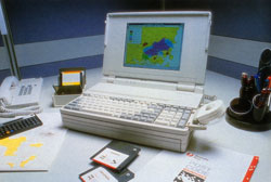
Postcode Boundaries on screen. |
Soon one of the last barriers to using postcode as the
key to integrating diverse geographically related data sets
in Australia will be removed. For while the key postcode
boundary data set has been available in the USA, United
Kingdom, and much of Europe, this has not been so in
Australia. In fact, until recently Australia Post's postcode
boundaries had never been officially mapped, let alone made
available as a digital data set for use in computer systems.
Certainly many organisations had attempted to reap the
boundaries and publish the results. A digital data set was
even built by selectively combining the smaller 1986 Census
collection district boundaries and calling the results a
derived postcode boundary data set.
So, any organisation actually wanting to use postcode to
unlock profits found no officially-sourced, accurate
definition of the postcode boundaries of Australia was
available.
In 1991, Australia Post teamed up with the Australian
Surveying and Land Information Group (AUSLIG) with a goal to
map and digitise the postcode boundaries of Australia and
make them available for use by industry, commerce and
government.
To cover this vast continent with the high degree of
accuracy required, over 2,000 base maps ranging in scale
from 1:1,000,000 to 1:10,000 were chosen and distributed to
Australia Post's post offices. The postal managers plotted
the postcode boundaries onto the maps which were then
checked and handed back to AUSLIG to be digitised.
By February 1992 AUSLIG had completed the process of
digitising the postcode boundaries from the maps. At all
stages of the digitising work an extremely rigourous set of
quality control checks were undertaken to ensure the high
accuracy standards set had been met or exceeded.
AUSLIG plan to have off-the-shelf, digital versions of
Australia Post's postcode boundary set ready for sale
through a national network of distributors by November 1992.
During the next few years we will see more and more
organisations utilising postcode to integrate their
information. Their marketing, operations and executive
information systems will all allow postcode to be used as a
common key. The results will be mapped using easy-to-use,
readily-available, desktop mapping software, and for the
first time spatial analysis of information will be simple.
It seems a characteristic of' Australian organisations to
sit back and watch before adopting the latest advances from
overseas. With postcode, this has enabled Australia Post and
AUSLIG to study the overseas examples and produce what is
arguably the most accurate and comprehensive postcode
boundary data set available in any nation.
Now it is up to Australian industry, commerce and
government to recognise the opportunities created by
grabbing the key and unlocking the doors to increased
profits.
Try it for yourself. Select an immediate and visible
decision for which you can easily acquire the necessary data
and analyse it by postcode. You will be surprised at the
value of the information you unlock. This initial win can
then be used to build support within your organisation for
using postcode as a key to spatial strategic thinking.
Local time: 3:57 am Friday 9 January 2026
|


